

Science Projects Archive
- Permits Issued in 2019
- Permits Issued in 2018
- Permits Issued in 2017
- Permits Issued in 2016
- Permits Issued in 2015
- Permits Issued in 2014
- Permits Issued in 2013
Response to environmental changes and post-industrial recovery of foraminifera from South Georgia fjords, sub-Antarctic
Wojciech Majewski
Because of its remoteness, South Georgia marine ecosystems remain understudied. The area has experienced a severe impact caused by whaling industry that ended in the 1960s. In consequence, it is a unique place to observe ecosystem response to human-induced environmental change, which exceed anything that can be seen during laboratory experiments.
The project focuses on foraminifera. The first two goals are (1) documentation of the biodiversity and distribution patterns of modern foraminifera, including poorly-known monothalamids and (2) to improve taxonomy of foraminifera and description of new species. Reaching these aims will provide a valuable baseline for recognizing future trends and an important insight into likely ecosystem changes linked to ongoing climate warming in the Antarctic Peninsula. The next two goals are (3) to reconstruct changes in foraminiferal faunas and (4) environmental conditions over the last 150 years. We will compare records from locations impacted by the whaling industry and those less impacted to assess resistance of South Georgia ecosystem to local but severe industrial impact and its capability to re-establishing natural communities. We will also reconstruct variations in sedimentation rates and the role of South Georgia fjords as sites of organic carbon burial.
During a short but successful field campaign on-board RSV Saoirse in late 2019, all material for reaching these goals has been collected. First analyses are already on their way. Our team got truly inspired by South Georgia’s nature and anticipates exiting scientific finds.

Surface Marine Meterology
South African Weather Service
Each year South Africa sets on a research and logistical cruise to Antarctica and the South Georgia and South Sandwich Islands. Activities on the cruise entail ship-based meteorological observations coupled with upper-air radiosonde balloon ascents. A buoy run which involves the replacement of 1 weather buoy at South Thule Island, and the handover of five buoys to South Georgia.
On the 2018/2019 cruise we replaced the stationary buoy on South Thule Island. The buoy gathers and transmits data to the Global Telecommunications System of the World Meteorological Organisation. These data are used in numerical weather prediction models.
This contribution to the Global Drifter Programme and International Programme for Antarctic Buoys would not have been possible without the kind logistical support of the South African National Dept. of Environmental Affairs, and assistance of future deployments by the governments of Falklands and South Georgia.
Where are they now? Right whales in the South Georgia marine ecosystem
Jennifer Jackson
Whales were heavily exploited in South Georgia during the 20th century with over 170,000 killed. Current whale recovery levels and habitat use patterns are unknown, so we are conducting surveys in South Georgia waters to gather information on the identity, habitat use, health and abundance of whales using these waters. Using genetic samples, we have identified that South Georgia right whales are most closely associated with southwest Atlantic calving grounds in Argentina and Brazil. In January 2019 we satellite tracked two humpback whales and followed their feeding ground movements. One travelled to the South Sandwich Islands and the other fed in South Georgia waters until June 2019 before travelling north to Brazilian wintering grounds. As part of this project we have also interrogated sightings data provided to the Grytviken museum, finding that since 2013 humpback whales are the most commonly sighted whale in South Georgia waters, with very large (100+) groups of whales now sighted annually.


Bird Island higher predator monitoring LTMS
Andy Wood
Since 1989, British Antarctic Survey (BAS) has used information from Bird Island as input to the Commission for the Conservation of Antarctic Marine Living Resources Environmental Monitoring Program on behalf of the UK. As an internationally important dataset contributing to global conservation issues, this work will continue for an indefinite future period. Long-term monitoring of population size and demography of albatrosses and petrels, contributes important data towards marine stewardship measures and conservation policy (e.g. Agreement on the Conservation of Albatrosses and Petrels). In addition, all data are combined into information for measuring the response by marine predators to change in the Scotia Sea ecosystem, a key objective for the BAS Ecosystems science programme.
Onset and modifications in intensity and pathways of water mass exchange between the Southeast Pacific and the South Atlantic with focus on the Falkland Plateau, Northern Scotia Ridge and the West Georgia Basin
Gabriele Uenzelmann-Neben
Cruise Leg MSM81 with RV MARIA S. MERIAN comprised seismic reflection studies of thehe Falkland Plateau. The Falkland Plateau rises up 1500 m above the surrounding seafloor and hence forms an obstacle for the exchange of water masses between high and lower latitudes. A detailed study and analysis of the structure of the Falkland Plateau and channel in the south via seismic data and a correlation with results from DSDP Leg 36 Sites 327, 329, and 330 as well as Leg 71 Site 511 was needed to supply information on the Cretaceous and Tertiary development of the Falkland Plateau and its influence on the path of the Antarctic Circumpolar Current, Upper and Lower Circumpolar Deepwater, South Pacific Deepwater, and Weddell Sea Deepwater. Seismic profiles were gathered, which capture the structure of the Falkland Plateau to basement and possible sediment drifts. Bathymetric and Parasound data were recorded parallel to the seismic profiling.
To complement the seismic studies SVP and XSV measurements at six locations and ADCP measurements across the whole working area were carried out.
Securing South Georgia’s native habitats following invasive species control
Rosemary Newton
South Georgia is a wildlife haven which has, until recently, been significantly impacted by introduced non-native reindeer and rodents. Reindeer were successfully removed in 2014 and the island was declared rodent free in May 2018. In response to the predicted grazing pressure release following mammal eradication, a non-native plant management strategy was developed by GSGSSI and is now being implemented.
In support of the South Georgia Non-Native Plant Management Strategy, this Darwin Initiative funded project is: assessing the effectiveness of non-native plant eradication efforts, estimating the risk of non-native plant species persisting past 2020 to inform future management activities, quantifying the potential for non-native plant species to spread into new areas exposed by retreating glaciers, and ensuring native plant species of South Georgia are secured in ex-situ conservation.
During the first field season (December 2018 – March 2019), 29 collections of 18 species were collected for research and conservation at the MSB, consisting of 11 seed collections from 6 native plant species, 7 seed collections of 5 non-native plant species and 11 spore collections of 7 native fern species. Contents from 30 seed traps and 130 soil samples were also collected for processing at the Millennium Seed Bank, Kew.

Aliens in the polar regions: Impacts of invasive species and invasion engineers on Arctic and Antarctic terrestrial ecosystems
Stef Bokhorst
This project aims to quantify impacts of invasive species on the functioning of Antarctic terrestrial ecosystems. By collecting soils along the Antarctic Peninsula and sub-Antarctic islands it is possible to compare the impact of soil quality and climate on the success of invasive species. This allows prediction of which sites are most vulnerable to invasive species and help focus the international efforts on the Protocol on Environmental Protection to the Antarctic Treaty which aims to protect Antarctic biodiversity and intrinsic values by preventing the unintended introduction to the Antarctic region of species not native to that region.
Tracking of juvenile grey-headed albatross
Richard Phillips
The grey-headed albatross is listed as Endangered by IUCN because of a steep decline at South Georgia since the 1970s. Recent analyses of long-term ring resighting data found that annual survival rates of juveniles were lower than expected and highly variable, some of which could be attributed to climatic variation. In addition, observers report immature birds being killed in pelagic longline fisheries in areas not used regularly by nonbreeding adults. Circumstantial evidence also suggests a possible density-dependent increase in predation by giant petrels as the chicks fledge and in the few days immediately thereafter when they often rest on the sea close to the island. The projects aims were to (i) map the movements and foraging areas of juveniles in order to determine overlap with fisheries, and (ii) assess the survival rate of juveniles post-fledging. The birds are being tracked in near real-time using the Argos system, and locations are shown on the project webpage:
https://www.bas.ac.uk/project/grey-headed-albatross-juvenile-tracking/
Investigating behavioural cues in Antarctic fur seals and macaroni penguins using novel animal-borne tags
Iain Staniland
The project forms part of a PhD using animal borne tags to investigate cues in marine mammal and seabird foraging. Miniature sound and movement tags (DTAG with high res accelerometer, magnetometer, depth sensor, GPS and hydrophone) were developed specifically for this application. The tags measured the marine soundscape in South Georgia waters. By combining acoustic with behavioural and location data, this project aimed at investigating how foraging Antarctic fur seals and macaroni penguins responded to biological acoustic cues (emitted by conspecifics, competitors, other marine predators feeding on the same resources, or their own predators). These data will be used to assess whether these animals use acoustic cues to find profitable prey patches while avoiding predation and competition.
Such information will greatly enhance our knowledge of predator ecology in the Scotia Sea and ultimately help understand their contrasting population trajectories.
Fitness consequences of niche choice and conformance in a colonially breeding marine mammal: roles of the social environment, genetic quality and offspring behaviour
Jaume Forcada
During the 2018-19 Antarctic fur seal pupping season, this project managed to successfully measure, sample and attach VHF (radio) tags to 50 mothers and their pups between December and March at two locations of Bird Island: Freshwater Inlet and Special Study Beach. The locations have different densities of pupping mothers, and were specifically selected to characterise the niche of the seals; the niche describes how animals respond to the environment, for example with changes in food and competitors. Multiple sources of data (behavioural, endocrine, immune, and genetic) were obtained, which will be combined to investigate if mothers selected niches to which they were a good fit, based on their physiology and behaviour, or they altered their behaviour or physiology to fit their niche. This choice is important for survival, reproduction, and adaptation to environmental change.
Macaroni foraging limits on the north coast of South Georgia
Philip Trathan
The primary objective of this study was to validate habitat usage models for krill eating penguins. Having representation of activity at sea will allows confirmation os assumptions used in existing models. This project set out to validate the dive trajectories of penguins using GPS, time-depth-recorders (TDR), accelerometers and video cameras. The work was undertaken at Bird Island, from the Fairy point and Goldcrest Point macaroni penguin colonies.
Instruments were attached during the incubation, brood and crèche periods of breeding. Equipment used includes: Pathtrack GPS devices (31.0 g in air; 63 x 24 x 22 mm with 40 mm whip antenna) and Sirtrack time-depth-recorders (TDR; 6 g in air; tubular 38 x 11 mm), accelerometers (6 g in air; tubular 38 x 11 mm) and video cameras (31.0 g in air; 63 x 24 x 22 mm). The devices have all been deployed on penguins previously.
Feather samples for genetic identification were also taken from each study animal. Two or three feathers were plucked individually from the back contour plumage.
Penguin Watch project
Tom Hart
Penguin Watch is a citizen science initiative set up by Oxford University in collaboration with other international research groups. Since 2009, the project haa sought to find solutions to the present data gaps in polar ecology, using cameras and genetic analysis, and collaborating with key stakeholders such as GSGSSI. Together, these approaches have resulted in a network of cameras across the Southern Ocean that can tease apart the confounded influences of climate change, fishing and direct disturbance on penguin populations.
Recent genetic analyses of Southern Ocean penguins have shown how distinct South Georgia and the South Sandwich Islands are with respect to Gentoo, Chinstrap, Macaroni and King Penguins: The project has also gone some way to explaining King Penguin populations over time and are doing the same for Antarctic Fur Seals. Through citizen science and automated computer vision, data from the (nearly two million) images from penguin cameras is being processed and turned into an information portal for the public and policy makers.

You can help this effort at www.penguinwatch.org. Media and engagement materials for schools are also available for download here
Western Core Box (WCB) science cruises
Sophie Fielding
DY098 was the 23rdoccupation of the BAS Polar Ocean Ecosystem Time Series Western Core Box (POETS-WCB), providing a consistent unique time-series of mesoscale distribution and abundance of Antarctic krill and an understanding of the physical environment within the region of South Georgia. Acoustic and net samples were completed across the northwest shelf of South Georgia.
Two moorings (one deep (3500m) and one shallow(300m)) were also deployed again to the northwest of South Georgia. These collect observations of zooplankton, ocean acidification and carbon flux as part of open ocean sustained observatories programme (Scotia Sea Open-Ocean Biological LaboratoriES).
Finally 2 weeks of the cruise were spent undertaking a large scale survey for Antarctic krill around the South Sandwich Islands. Acoustic transects, CTDs and net samples were undertaken to provide new information on the distribution of krill near these remote islands. In addition samples were also taken to examine microplastics and their influence on the marine ecosystem.
King penguin paleoecology, colony occupation history, and historic diet trends in South Georgia
Michael Polito
This project collected sediments and organic remains from beaches and drainages around active king penguin colonies. Samples will be analysed for radio and stable isotopes and bio-elements proxies of seabird guano in sediments to identify occupation trends and diets of penguins relative to historic and paleo-climate variability in South Georgia. These studies will complement past and on-going work with the using these same methods in the South Shetlands, South Orkneys and the Antarctic Peninsula.
Bongo net collection of zooplankton
By Andrew Rees
The AMT project (www.amt-uk.org) has provided a sustained series of observations in the Atlantic Ocean between the United kingdom and the South Atlantic for 22 years.
A few of the primary goals of the AMT programme are to provide a means to assess biodiversity trends in relation to environmental change, improve our understanding of the structure and functioning of marine ecosystems, and understand the impact of climate change on the ocean. Our research is related to these efforts in that 1) we aim to assess biodiversity (both at specific and genetic levels) of several important components of pelagic foodwebs (copepods, amphipods, chaetognaths and planktonic gastropods), and 2) the ability of zooplankton to respond to future changes in the ocean depends on the genetic structure of populations over space and time.
Intertidal invertebrates from South Georgia Island as a key for understanding biogeographic patterns in the Southern Ocean
By Carlos Levia
Due to its position south of the Polar Front and lapped by the SO cold waters, the SubAntarctic South Georgia Is. allows the presence of typically Antarctic species. This biogeographic feature is crucial from the evolutionary history point of view, due to the relevant role that South Georgia may have played as glacial refugium in the past. The shallow-waters of South Georgia Island are home of marine invertebrates that are also found in other Antarctic regions such as the Antarctic Peninsula and the South Shetland Islands.
The main goal of my project was to collect samples from a selection of these shallow-water species with wide distribution (including nemerteans, annelids and platyhelminthes) present at different locations in the intertidal of South Georgia. This will allow determining the molecular connectivity and phylogeographic patterns of the species using these samples together with samples collected in previous cruises in the Antarctic Peninsula and South Shetland Is. This work is part of Carlos Leiva’s PhD conducted at the University of Barcelona and the Natural History Museum of London.
Ecological Studies of Pinnipeds and Seabirds
Brent Stewart
The goals of the aerial surveys using small drones were to document abundance and distribution of animals relative to dynamic characteristics of habitats and local climate. The project also continued research on the development and use of particular methods for population level assessments (photo-graphic identification of individuals, and vocal identification of individuals), to use in short and long-term population studies. These are all non-intrusive studies that do not involve disturbance to animals as the photographs and vocalizations can be collected at some distance with the recording equipment. The long-term objective of these studies is to apply these photographic and acoustic methods to document and monitor reproductive effort and reproductive success of penguins and other seabirds and elephant seals and fur seals.
West Wind Expedition
Paul Mayewski
Glaciers on South Georgia Island preserve ice that fell as snow hundreds or thousands of years ago. When that snow fell, it trapped small amounts of atmospheric gases and dust, which became incorporated into glacier ice. We collect samples of this ancient ice to extract chemical clues about past climate and human activity in the area around South Georgia, the Southern Ocean, and the Southern Hemisphere.
The project used a variety of techniques to analyse glacier ice in our laboratory. Preserved stable isotopes of oxygen and hydrogen give us information about temperature and precipitation in the past. We measure trace-levels of elements both in frozen ice and in melted samples to determine seasonal and long-term trends in chemical inputs to the atmosphere; these could reflect anthropogenic activity, changing climate, or varying local conditions
Where are they now? Right whales in the South Georgia marine ecosystem
Jennifer Jackson
In 2018, the British Antarctic Survey conducted a survey of right whale distribution, health and population identity on the north coast of South Georgia, using acoustics to localise whales and collecting photo-identifications and skin biopsies of individuals. Although this expedition was hampered by storms and high winds (limiting the survey to ~5 days of workable weather), it encountered right whales 31 times, yielding 21 photo-identifications of different individuals along the north coast of South Georgia. Directional acoustics also detected Antarctic blue whales towards the South Georgia shelf break. Many of the encountered right whales were skinny, and their body condition is now being analysed using photographs, and the individual right whale photo-IDs are being compared with their low-latitude calving grounds in Argentina and Brazil to find matches (i.e. migratory connections). The life histories of many individuals on these calving grounds are well known, so linking these whales with their occurrence in South Georgia and observing their body condition is important.


Plant and soil succession in a receding glacier foreland on South Georgia
Elisabeth Biersma
An international group of researchers spent two months conducting fieldwork at
Husvik, South Georgia, on successions of plants, microbes and soils in a receding glacier foreland. The foreland, previously studied by former BAS botanist Ron Lewis Smith in the 80’s and 90’s, consists of a well-defined set of moraines spanning nearly a century. By revisiting the site we hoped to gain invaluable insights into the way in which polar terrestrial ecosystems develop over time. As well as repeating observations made on the plant community, we extended the project to include a strong biogeochemical angle, aiming to quantify and scale changes and rates in both biological and geochemical succession, including trace gas fluxes between soils and the atmosphere, after glacial retreat.
The field team comprised of staff from institutes across Europe (BAS; CENPERM, University of Copenhagen) and South America (University of Brasília; University of Talca). Thanks to the BAS Operations Team, KEP, RRS Shackleton, MV Pharos and GSGSSI for making the fieldwork a success!

Three members of the field team in front of the glacier foreland in Husvik, South Georgia.
Bird Island Higher Marine Predator LTMS
Andy Wood
Since 1989, British Antarctic Survey (BAS) has used information from Bird Island as input to the Commission for the Conservation of Antarctic Marine Living Resources
Environmental Monitoring Program on behalf of the UK. As an internationally important dataset contributing to global conservation issues, this work will continue for an indefinite future period. Long-term monitoring of population size and demography of albatrosses and petrels, contributes important data towards marine stewardship measures and conservation policy (e.g. Agreement on the Conservation of Albatrosses and Petrels). In addition, all data are combined into information for measuring the response by marine predators to change in the Scotia Sea ecosystem, a key objective for the BAS Ecosystems science programme.
Investigating microplastics in sub-Antarctic beach sediments
Claire Waluda
Plastic pollution of the oceans is recognised as a global issue, but we have limited knowledge about the presence and impact of plastics in the Southern Ocean. While it is known that large plastic items can be ingested by seabirds or cause entanglements in seals, only recently has the potential impact of microplastics on the environment and marine animals of the Southern Ocean been recognised.
Microplastics are particles less than 5mm in diameter which can derive from cosmetics, washing synthetic clothing and from the breakdown of larger items of plastic ocean debris. Microplastics have the potential to accumulate up the food chain and which can result in harmful physical and chemical impacts on marine biota.
At South Georgia we collected samples of beach sediments from around Bird Island and Cumberland Bay, these will be compared with samples taken from various beaches along the Scotia Sea coastal margins. The aim of this project is to provide a baseline index of the level of microplastics pollution in the Southern Ocean across a latitudinal gradient from the Antarctic Peninsula to the South Orkneys and South Georgia.
Tracking of juvenile grey-headed albatross
Richard Phillips
The grey-headed albatross is listed as Endangered by IUCN because of a steep decline at South Georgia since the 1970s. Recent analyses of long-term ring resighting data found that annual survival rates of juveniles were lower than expected and highly variable, some of which could be attributed to climatic variation. In addition, observers report immature birds being killed in pelagic longline fisheries in areas not used regularly by nonbreeding adults. Circumstantial evidence also suggests a possible density-dependent increase in predation by giant petrels as the chicks fledge and in the few days immediately thereafter when they often rest on the sea close to the island. The projects aims were to (i) map the movements and foraging areas of juveniles in order to determine overlap with fisheries, and (ii) assess the survival rate of juveniles post-fledging. The birds are being tracked in near real-time using the Argos system, and locations are shown on the project webpage:
https://www.bas.ac.uk/project/grey-headed-albatross-juvenile-tracking/
Investigating behavioural cues using animal-borne tags
Iain Staniland
Efficient foraging is critical for central place foragers that provision offspring on land via prey caught at sea. Despite recent developments of biologging technologies, there is little information on how seals and penguins find prey patches in the Southern Ocean. This project aims to investigate the sensory ecology of Antarctic fur seals and test whether or not they use acoustic cues to find their prey and avoid competitors and predators.
Novel high resolution animal borne tags were deployed on 8 female fur seals at Fresh Water Bay on Bird Island during the breeding season (December – February 2018). These miniature tags recorded a unique dataset on movement (accelerometer and magnetometer), position (GPS and depth sensor) and acoustic environment (hydrophone sensor) during entire foraging trips.
Such information will greatly enhance our knowledge of predator foraging and sensory ecology and ultimately help to better understand their role within rapidly changing Scotia Sea ecosystems.
White-chinned petrel monitoring at Bird Island
Richard Phillips
The white-chinned petrel is the most common bird recorded as fisheries bycatch in the Southern Ocean. It is listed by ACAP (www.acap.aq), and as Vulnerable by IUCN (although the limited trend data suggest uplisting to Endangered may be warranted). At Bird Island, there was a decrease of 28% (equivalent to 2% per year) in burrow occupancy of white-chinned petrels from the late 1970s to late 1990s. A repeat census was carried out in Dec. 2016 – Jan. 2017, and the purpose of the current project is to collect data for interpretation of burrow occupancy rates, which vary considerably. The aims are to (i) relate call rates from acoustic loggers to weather patterns, moonlight levels, and other environmental variables, (ii) monitor adult attendance patterns and breeding success using tape playback and burrowscoping, and (iii) relate call rates from acoustic loggers to attendance patterns and response rates to tape playback at burrow entrances, to improve estimates of population size of white-chinned petrels.
Overlap of Gentoo foraging ranges and diets with the krill fishery during winter
Normal Ratcliffe
A fishery for Antarctic krill (Euphausia superba) operates over the shelf breaks of the South Orkney, South Shetland and South Georgia archipelagos. Krill is an important food source for large populations of penguins, flying seabirds, seals and baleen whales and the potential for competition with these predators is one of the major considerations in the management of the krill fishery.
The krill fishery around South Georgia operates during winter when the spread of sea ice restricts access to preferred fishing grounds further south. Closure of the fishery during summer has been adopted as a management measure, with the Government of South Georgia and the South Sandwich Islands (GSGSSI) marine protected area (MPA) management plan, in order to avoid competition with seabirds and seals during the breeding season. Winter fishing is permitted on the rationale that movement of krill-dependent predators away from their colonies during this period will greatly reduce the potential for competition. This assumption is valid for macaroni penguins, which disperse away from the South Georgia krill fishing grounds during winter. Gentoo penguins are residents at South Georgia, and during the winter period they continue to forage inshore and roost on land at night. This creates potential for the fishery to compete with gentoo penguins for food during the winter period, but their degree of spatial overlap and how this changes during the course of the winter has yet to be determined. This project aims to fill this key information gap and provide advice to the South Georgia MPA review in 2018.
In mid June 2018 16 gentoo penguins were equipped with Sirtrack Kiwisat (202 K2G 273A) satellite transmitters at winter roosts in Cumberland Bay and the Barff Peninsula. The tags relay positions via the ARGOS system for around 70 days so there is no need to recapture the birds to obtain data; an important requirement since gentoo penguins do not always return to the same roost site each night and may range considerable distances along the coast. Movement of the birds can be found at: https://www.bas.ac.uk/project/gentoo-penguin-tracking/

Ecological studies of pinnipeds and seabirds
Brent Stewart
The use of UAV’s is an excellent tool to allow large numbers on animals that are
concentrated in relatively small areas to be documented with high resolution aerial imagery and late be counted estimate the number and species and age composition of these aggregations. Weather (wind, rain, snow, low clouds and fog) is an important physical factor that can influence the success of the application of this tool in wildlife studies, particularly at places like South Georgia where weather is generally intense, often unpredictable, and rapidly changeable especially when visits to sites are tightly scheduled and brief. The most approach to conducting surveys with UAVs at these locations is to be pragmatically conservative to avoid impacts to wildlife, loss of the UAV, and respect to the concerns of tourists over wilderness values and aesthetics.
Extent of mercury exposure in Gentoo penguins
David Schutt
Permitted activity consisted of collecting feathers from previously dead penguin carcasses to analyze mercury exposure in penguins as an indicator of mercury levels in the surrounding waters in which the penguins feed. This investigation is part of a larger study looking at mercury exposure in penguins throughout the Falkland Islands and Antarctica. Analysis has not yet been performed on the collected samples.
Mapping Falklands and South Georgia coastal margins for Spatial Planning
Tara Pelembe
Coastal areas are critical to humans and wildlife. Knowledge of these environments is essential to their conservation and management and they have been subject to little study regionally. While South Georgia receives less human impact than neighbouring islands in the South Atlantic such as the Falklands, the island provides a habitat for important bird and marine mammal communities, which extend around its coastline.
This fieldwork undertaken on South Georgia was part of a Darwin Plus funded project (grant aided by the Darwin Initiative through UK Government funding) titled “Mapping Falklands and South Georgia coastal margins for Spatial Planning” and is helping to map these important habitats. The project is a joint effort between the Government of South Georgia and the South Sandwich Islands, the South Atlantic Environmental Research Institute, Falkland Islands Government, Oregon State University, Shallow Marine Surveys Group and the UK’s Joint Nature Conservation Committee.
This fieldwork through November and December 2017 involved collecting photographs to record the range of coastal habitats. These photographs will then be used to ‘train’ computer software to help create maps of South Georgia’s coastal habitats. The maps will contribute to important baseline information, and provide a sound basis for planning, decision-making and monitoring.
Surface Marine Meteorology
Tania Williams
Each year South Africa sets on a research and logistical cruise to Antarctica and the South Georgia and South Sandwich Islands. Activities on the cruise entail ship-based meteorological observations coupled with upper-air radiosonde balloon ascents. A buoy run which involves the replacement of 1weather buoy at South Thule Island, and the handover of five buoys to South Georgia.
On the 2017/2018 cruise we replaced the stationary buoy on South Thule Island. The buoy gathers and transmits data to the Global Telecommunications System of the World Meteorological Organisation. These data are used in numerical weather prediction models.
This contribution to the Global Drifter Programme and International Programme for Antarctic Buoys would not have been possible without the kind logistical support of the South African National Dept. of Environmental Affairs, and assistance of future deployments by the governments of Falklands and South Georgia.
COMICS glider recovery on BAS cruise
Hugh Venables
Ocean glider were deployed from the RRS Discovery in the Georgia Basin as part of a Southampton-led project in December 2017. After staying at and collecting data in the top 1000m they were collected by the RRS James Clark Ross in mid February. Water samples were taken to help calibrate and interpret the data collected by the ocean gliders during their mission.
Nano-Polymers in the Antarctic marine environment and biota (NanoPANTA)
Claire Waluda, British Antarctic Survey
Plastic pollution is now reaching the most remote parts of the planet, including Polar seas and the deep ocean floor. The work done at South Georgia is part of a multi-national project that aims to investigate the presence and origin of nano-sized polymeric particles (NPPs) from marine debris in the Antarctic marine environment and biota as well as to evaluate the potential effects of NPPs on key Antarctic species.
Using the samples obtained we are currently investigating the presence of NPPs in higher predators and zooplankton from South Georgia. Short-term (48 h) incubation experiments performed on board JCR vessel showed that NPPs are able to affect krill swimming behaviour and alter density and sinking rate of krill faecal pellets. Microbiological characterization and gene expression analyses are currently ongoing. Our results represent a first contribution to determine the potential impact of NPPs to the Antarctic krill.
The South Georgia Wave Experiment (SG-WEX)
British Antarctic Survey and University of Bath

The King Edward Point meteor radar is part of a collaborative research project between the Universities of Bath, Leeds, the British Antarctic Survey and the Met Office. The project studies the effect on the atmosphere of the isolated, mountainous island of South Georgia. The radar detects the drifting of meteor trails at heights of about 80 – 100 km, effectively the edge of space. The meteor trails are carried by the winds of this tenuous outer part of the atmosphere and so tracking their motion reveals these winds. The radar operates continuously and has been measuring the atmosphere over South Georgia since February 2016. The results reveal that the motion of the atmosphere includes a rich variety of atmospheric waves and tides, in some ways similar to waves and tides in the oceans. In fact, the atmospheric tides measured over South Georgia are among the largest measured anywhere on Earth. Future studies will investigate if atmospheric waves generated by winds blowing over the mountains of the island are able to directly propagate to these great heights, where they may deposit energy and momentum carried from near the surface and so influence the circulation of the atmosphere.
Stable water isotope analysis of surface water samples
By Heini Wernli, ETH Zurich, Switzerland
 Our project quantifies key aspects of the Southern Ocean water cycle by performing stable water isotope (SWI) measurements in atmospheric vapour, precipitation and surface waters. Together with sophisticated meteorological diagnostics (e.g., air parcel trajectories, moisture source analysis, cyclone tracking), these observations provide a unique opportunity to investigate the water budget over remote islands, e.g., South Georgia. We collected small water samples from lakes and a river at different altitudes and will analyse the isotopic content (d2H and d18O) of these samples in our lab at ETH Zurich during the coming months. The results will provide interesting information about the variability of stable water isotopes in surface waters on South Georgia.
Marine Plastic Research
By Carolina Rodriguez
Plastic marine pollution have being well documented in all the oceans around the world, but just few recent works are recording the presence of microplastic in pristine areas such as the southern ocean, Antarctic and subantarctic marine areas.
 In this way, Uruguayan researchers are working in global environmental human impacts on coastal-marine Antarctic and sub-antarctic ecosystems, particularly in the Antarctic Peninsula, near the Artigas Antarctic Research Station, Maxwell Bay, King Jorge Island, with the objectives of evaluating the concentration of plastics and microplastics and adsorbed persistent organic pollutants in marine surface water, and their possible effects on the Antarctic marine wildlife.
With the British Royal Navy collaboration in HMS Protector, we are now expanding the sampling area of the main work, taking samples of floating marine debris during the ship survey in South Georgia Islands, Falkland and Antarctica, developing the Uruguayan marine plastic pollution research.
Atmospheric and Surface Ocean Research
South African Weather Service
On annual basis, the South African government conducts a dedicated logistical voyage to its SANAE base, on Antarctica and the South African Weather Service is one of the stakeholders with vested interests in understanding the climate system from the Antarctic region. The South African Weather Service with the support of the National Department of Environmental Affairs, South Africa, has deployed 14x drifting weather buoys off the SGSSI on board the R.V. SA Agulhas II. The buoy deployments were conducted as part of contribution to the buoy network array coordinated by the Data Buoy Cooperation Panel, in order to monitor the climate system in the Antarctic region. However, these deployments happened after the stationary buoy at Thule was replaced. At least 5x drifting buoys were handed over to the Government Officers at the King Edward Point to be deployed later by the Pharos SG.
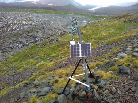
Pollen rain around the Scotia Arc
Tom Hart

A timelapse camera at St Andrews, showing two pollen rain traps attached to the support pole. These traps consist of a plastic tube half filled with glycerol, covered with a gauze mesh and attached to the pole with wire or jubilee clips.
The method of investigating long-distance pollen dispersal by catching the pollen rain has only a short tradition in Antarctica, but Antarctic areas have attributes that encourage the study of long-distance dispersal especially associated with the colonization of terrains uncovered by glaciers which largely depend on long-distance transfer as well as on ecological conditions.
In 2015/16, we visited South Georgia and placed 10 pollen traps on existing time-lapse cameras near penguin colonies. As we build up a picture of pollen dispersal around the Scotia Arc and Antarctic Peninsula, it will help us to understand colonisation and dispersal in a changing climate.
Censusing and genetic monitoring of penguins and seals around South Georgia
Tom Hart
Remote wilderness is a defining characteristic of South Georgia and the South Sandwich Islands, but their isolation also makes monitoring and study extremely difficult away from bases like King Edward Point and Bird Island. Over the last few years, a team from Oxford University have been deploying timelapse cameras around to monitor the health and recovery of seabird and seal populations. Cameras take a photos every hour, from which we can determine the arrival dates, survival and reproductive success of each nest within the field of view.
Images from time lapse cameras are placed on www.penguinwatch.org, where volunteers help us to extract the data from imagery, as we work on a computer vision algorithm to automate the process. Since its launch in 2014, over 4 million people have participated in this citizen science project, which is now one of the largest in the world.

Collection of macaroni penguin ‘A’ eggs to examine for maternal antibody transmission.
By Norman Ratcliffe
Penguins are thought to be particularly prone to diseases based on studies of captive birds. Changes in climate and human activities in South Georgia and Antarctica may facilitate transmission of diseases and penguin’s susceptibility to these. British Antarctic Survey and the Vet School at Cambridge University have initiated a study to examine prevalence of different disease types in wild penguins on South Georgia and the South Orkneys. On Bird Island, we collected 54 first-laid eggs from the nests of known-age macaroni penguins. This would have no impact on breeding success as, bizarrely, this species always ejects the first laid egg from the nest. Females transfer antibodies to the egg to enable chicks to fight infections post-hatching prior to them acquiring their own immunity, so studies of ejected eggs provide a low-impact method of assessing disease prevalence and infection rates.
Stable isotope studies of liverwort-fungal associations in the sub-Antarctic
By Kevin Newsham
Samples of liverworts, mosses and higher plants were collected to test the hypothesis that these groups of plants differ in their 15N stable isotope ratios. This follows up similar work done at Ny-Ålesund on Svalbard, in which significant differences were found between the three groups of plants and underlying soil, possibly associated with habitat type and with high 15N isotope ratios of bird and other animal guano. The samples are still undergoing processing and we cannot as yet provide an indication of what was found.
Ecosystems Programme Western Core Box Programme
By Gabriele Stowasser
Since 1981 BAS have undertaken cruises to determine krill biomass as part of the ongoing assessment of the status of the marine ecosystem in the region of South Georgia. This unique time series, known as the Western Core Box, is part of the Ecosystems Programme contribution to BAS national capability. It comprises an acoustic grid survey of 8 transects each of 80 km in length, together with associated net and oceanographic sampling and the calibration of acoustic instrumentation. In addition to the acoustic survey, which covers a wide area but has limited temporal coverage, there are two moorings (In deep water to the southwest and northwest of South Georgia) to provide a temporal, year-round set of observations. These moorings are recovered during the cruise, refurbished and data downloaded, and then re-deployed later in the cruise
Measurements of the oxygen isotope composition of seawater
By Andrew Meijers
By measuring the relative concentration of oxygen 18 to oxygen 16 atoms (d18O) in seawater molecules it is possible to discern the type and to some extent, location, of freshwater sources contributing to local seawater properties. For example, glacial ice melt has a distinctly different d18O signature to sea ice melt, so by repeated measurement of ocean water d18O properties it is possible to tell if changes in observed salinity (and hence circulation) are driven by increased glacial melt vs changes in sea ice concentration. However, in order to do this accurately the d18O characteristics of local freshwater sources to the ocean must be well known. This project forms the baseline observations for both Scotia/Weddell Sea d18O properties, as well as ascertaining the d18O characteristics of local sea-ice, precipitation and glacial freshwater sources. South Georgia is a significant source of both precipitation and glacial runoff to the Scotia Sea, so we have focussed on collecting samples from both local sea waters as well as glaciers and meltwater lakes. These d18O ‘end members’ to the Scotia Sea will be compared with Weddell sea-ice and Signy Island glacial samples, and their respective properties used to assess their relative importance of these freshwater sources in setting Scotia Sea deep and surface ocean properties. Over time measurements such as these will allow us to assess the impact of changes in precipitation and glacial melt on ocean circulation, carbon and heat uptake in the Scotia Sea and wider Southern Ocean.
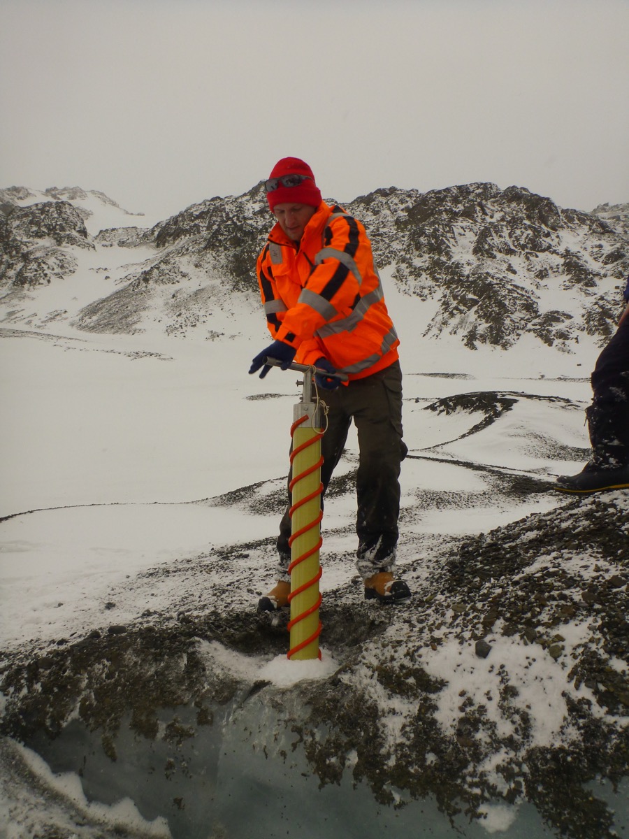
Dr. Andrew Meijers taking an ice core from Glacier Col (By Robert Mulvaney).
Beached bones: historical genetic diversity of great whales from South Georgia Whaling Stations
By Angela Sremba
We aim to describe the historical genetic diversity of great whale populations that were exploited in waters surrounding South Georgia island during 20th century commercial whaling. We plan to collect whale bone samples from the shorelines near abandoned whaling stations on South Georgia Island for species identification and estimates of genetic diversity. As bone fragments are degraded and fragmented, we will extract DNA in the laboratory and use genetic methods to identify species and describe historical genetic diversity (Sremba et al. 2014). We plan to compare the historical genetic diversity that is representative of the preexploitation whale populations to contemporary populations (Sremba et al. 2012). Results of this study will be published in a peer reviewed journal and shared with GSGSSI for their website.
Westwind Expedition
By Paul Mayewski
As a consequence of greenhouse gas warming and the Antarctic ozone hole Southern Hemisphere westerly winds are migrating poleward and intensifying, with potentially significant impacts on the distribution of heat, moisture, pollutants, storm patterns, sea surface currents and temperature, and marine ecosystems. Predicting the future of westerly wind behaviour is critically important and instrumental records cover at best a few decades and are sparsely distributed. Ice core records offer a robust tool for investigating past climate and predicting future climate. South Georgia glaciers are melting at a dramatic rate so the Westwind Expedition is searching for appropriate sites from which a viable ice core record can be recovered. In October 2015, a 15.38m reconnaissance ice core was recovered from the Briggs-Esmark region and is currently being analysed to determine whether or not the site warrants future investigation for recovery of a longer record covering hundreds to thousands of years at annual and finer resolution.

By Ben Burpee
Little is known about South Georgia lake ecosystems. Though some work has been done to assess the composition of algal communities, there is very little water chemistry data available for South Georgia lakes. Water chemistry—such as nutrient concentrations, turbidity, salinity, and dissolved organic carbon concentrations—can be important in determining algal community structure. In this project a 12-lake survey on the North side of South Georgia was conducted to collect water chemistry and sediment samples, which contain siliceous algal remains. Lake sediment cores were also collected to assess past algal communities and ecological conditions. With these data, it will be able to determine forcers of algal community composition across this unique sub-Antarctic landscape. This research will be important to understand how South Georgia lake ecosystems have responded to past climate changes, and predict how they might respond to future ones.

Soil and Moss Sampling on the South Sandwich Islands
Dr Tom Hart and Gemma Clucas
 Peat cores from Candlemas Islands were obtained are at the request of Prof Peter Convey (British Antarctic Survey) and will form part of a wider series of studies examining growth rates, palaeoecological and palaeoclimatological indicators across the maritime Antarctic. They provide a valuable extension to currently available sample material from sites ranging between the South Orkney Islands and northern Alexander Island. While specific publications relating to the South Sandwich Islands alone are not envisaged (although these cores will provide the first such palaeo record from the archipelago), the wider project to which they will contribute has already proved to be highly productive, generating several highly influential publications.
Higher Predator Monitoring at Maiviken, Cumberland Bay
Stephanie Winnard – British Antarctic Survey
Long term monitoring of Antarctic fur seals (Arctocephalus gazella) and gentoo penguins (Pygoscelis papua) has been ongoing at KEP since 2008. This year monitoring of giant petrels (Macronectes halli/Macronectes giganteus) was reintroduced. Breeding success is monitored through bi-daily photo counts for seals, and nest monitoring of gentoo penguins and giant petrels. The young are weighed/measured to assess health prior to fledging. Diet is also monitored year round for fur seals.
The aim of the work is to provide data showing long term trends, as well as annual variations in the breeding success of the higher predators of South Georgia. Specifically of interest are those reliant on krill, which is a keystone species that many other animals rely upon for food either directly or indirectly. Breeding success and diet information can provide important indicators of the general health of the ocean ecosystem and local stocks levels. This data is used by CCAMLR to help implement conservative fishing quotas each year that will not impact on the food chain.
Global Navigation Satellite System (GNSS) Measurements at King Edward Point
by Norman Teferle
In March 2014 Professor Norman Teferle and Dr Addisu Hunegnaw, both from the University of Luxembourg, visited King Edward Point (KEP) to continue their work in support of research into land movements and sea level changes of/around South Georgia Island. They serviced the continuous GNSS station on Brown Mountain, installed of a second one directly at KEP, installed a tide board at the jetty to calibrate the tide gauge and carried out a number of high-precision geodetic surveys between all these instruments. From the collection of these data it will be possible to learn if South Georgia Island is part of the Scotia tectonic plate or whether it is micro-plate between the South America and Scotia tectonic plates. The measurements will also show if the point on Brown Mountain is rising or subsiding and if KEP is doing the same, i.e. is stable. This is important in order to juge if the tide gauge measurements show real sea level changes or just artefacts of rising or subsiding land. For more information see http://hdl.handle.net/10993/17359
Diversity of Collembola on South Georgia
Jessica Hoskins – Monash University
Collembola are amongst the most widespread and abundant group of animals in the soil, and play an important role in nutrient cycling. They are usually one of the most important groups of terrestrial organisms on sub-Antarctic islands. Pervious studies have focused on King Edward Point (KEP), Grytviken and Husvik, and no collections have been made in remote parts of the island.
In this project samples were taken from 14 different sites around South Georgia where collections had previously never been made. Collembola were collected using aspirator techniques and soil cores were taken. The soil cores were taken back to KEP so that the species of soil dwelling collembola might be extracted. These two methods were used in an attempt to get high species diversity. The number of species we collected will not be known until the samples arrive at our lab in Melbourne and we are able to study them under the microscope.
Potential Dietary Changes in Skuas following Eradication of Alien Species (Brown Rats) at South Georgia
Richard Phillips – British Antarctic Survey
This project investigates possible dietary changes in brown skuas following the eradication of brown rats. Stable isotope ratios will be measured in feathers taken from skua chicks (each from a different brood), and in small samples of dried muscle tissue from representative prey found dead in the same areas (brown rats; Antarctic prions, diving petrels, penguins and other seabirds; seal carrion; other items if available). The intention is to collect samples in the same areas in years before and after the rodent eradication, i.e. Jan-Feb. 2015 and 2016. Comparable material will also be obtained from Bird Island as part of the routine monitoring.
Tracking of Seabirds at Bird Island
Richard Phillips – British Antarctic Survey
The project involves the tracking of several species (wandering, black-browed and light-mantled albatrosses, white-chinned petrels and brown skuas) using a range of devices (satellite-transmitters, GPS loggers, immersion loggers and audio loggers) to examine distribution, activity patterns, interactions with conspecifics and fishing vessels, and other aspects of foraging ecology. Feathers and a small blood sample will be taken from some species for molecular sexing and analysis of stable isotope ratios to infer diet.
Extreme Ice Survey: Time-Lapse Cameras
The Extreme Ice Survey has installed six time-lapse cameras on South Georgia Island at three locations, including Risting Glacier in Drygalski Fjord, Nordenskjöld Glacier in Cumberland East Bay and Bertrab Glacier at Gold Harbor. The camera systems include a Nikon digital camera and a custom timer that are housed in a waterproof case and powered by a battery and solar panel. These cameras, installed in 2014, join more than 30 other cameras currently installed at glaciers in Greenland, Alaska, Canada, Iceland, the Alps, and the Antarctic Peninsula. The cameras capture photographs hour after hour, day after day, allowing us to monitor both glacier extent and ice velocity, while creating a visual record of these changing landscapes. We encourage you to learn more about our project at www.extremeicesurvey.org
Penguin Monitoring using Counts, Cameras and Samples
by Tom Hart
The Penguin Lifelines project, based at Oxford University, has been developing new monitoring techniques to track the health of South Georgia seabird populations.
Tom Hart and his team visited South Georgia in November 2013. They collected DNA samples from different species of penguin to investigate and monitor the population structure and change of seabird populations over time. Time-lapse cameras have been installed and used to record short-term changes at breeding colonies. For more information on this project and to see a sample of the time-lapse imagery, see www.penguinlifelines.org, or to help count penguins in images taken on South Georgia, visit www.penguinwatch.org.